Our Sponsors


Paddling in the Ohio River
Unfortunatley the Ohio River is very under utilized by paddlers, largely due to the misconception that it is more dangerous than paddling other waterways, or that the water quality is particularly poor. During the summer months the speed of the current in the Ohio River is usually about .5 MPH which is generally barely noticable and essentially turns the river into a long lake. Like any stream, the water level will vary depending on how wet the season has been, and it's necessary to watch the water levels as well as make a careful observation of the river's conditions before setting out to paddle. The main thing to watch out for is large floating debris (like trees) when the river level is high. But, in general, paddling on the Ohio is just as safe as paddling on any lake in the area.
Common Places to Paddle
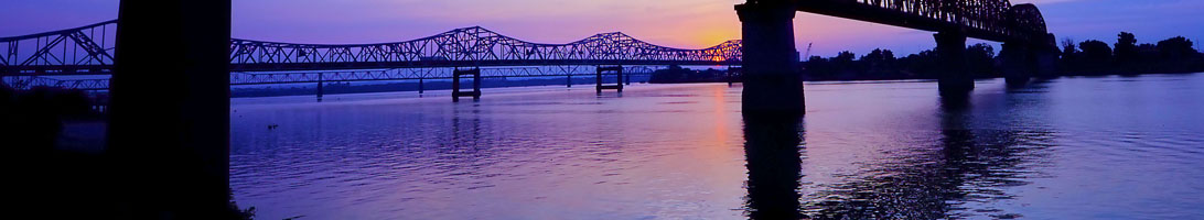
- Downtown Louisville: One of the most scenic places to paddle is downtown Louisville. Put in at the Louisville Community Boathouse and paddle down to the 2nd street bridge (but not past it). Paddle across to the Indiana side, back upstream and back across. Doing this paddle near sunset or after dark provides a very scenic view of downtown Louisville, but be warned that the lights from barges and other motor boats tend to blend in with the city lights and can be hard to pick out.
- The Falls of the Ohio:. See below for a more in depth discussion of paddling at the Falls.
- Six Mile Island: Six Mile Island is designated as a Kentucky State Nature preserve, you can get out and explore it, but most people choose to just paddle around it. If you put in at Cox Park on the Kentucky side and paddle up and around the island, it turns out to be about a six mile paddle that takes a little over an hour. So this is a common "quickie" paddle many people do during the week after work.
- Party Cove: The unofficially named "Party Cove" is a common destination for motor boatist since it's usally fairly calm water. It is the cove on the Indiana side just a little upstream from Six Mile Island. Upon entering you'll see a sign stating something along the lines of a Supreme Court decision stating it's not legal to enter, but you can ignore the sign as it's not correct.
- Locking through the McApline Lock:. See below for a detailed discussion of locking through.
- Beargrass Creek: Beargress Creek is accessible by paddling upstream just a little ways from the Louisville Community Boathouse. Unfortunately it's quite polluted and often smells of dead fish. But on a good day provides an alternative to the wide open views on the Ohio.
- 14 Mile Creek: 14 Mile Creek is accessible by launching form Charlestown State Park ($7 entry fee) and paddline upstream about 1.5 miles along the Indiana side. It is a remote creek not surrounded by any man made structures and has an abundance of wildlife. Gas powered boats are prohibited, and it's remoteness means there's not a lot of other traffic to disturb the wilderness.
- Rose Island: Since Charlestown State Park built a bridge to it, it's not as novel anymore but you can still paddle there. Rose Island is the bank on the upstream side of 14 Mile Creek on the Ohio. There are no great places to get out due to the semi-steep banks, but search around and you can find a spot that works.
- 12 Mile Island: You can access 12 Mile Island as a short paddle from Charlestown State Park, or as a long paddle from Harrods Creek Boat Harbor. This island is owned and maintained by Jefferson County and Oldham County, there is a wooden ladder on the Kentucky side near the middle of the island making it easy to get to the top. This is a common destination for many people and on a nice day will have many people hanging out, playing volley ball, using the rope swing, etc.
- 18 Mile Island: 18 Mile Island can be accessed easily from the boat ramp in Westport. It is privately owned, but has a nice beach available for public use. It is also common for many motor boatist to tie off on the narrow passage on the Kentucky side to get out and swim.
- Cincinnati to Louisville: It's a long paddle, but a lot of people have done it.
Water Quality
While I wouldn't drink the water out of the Ohio River directly, it is generally just as clean or cleaner than most of the surrounding streams and lakes. One particular source of bad water quality for all of the area streams is sewer overflows. MSD has a webpage that alerts you when there has potentially been a recent sewer overflow, you can access the page at http://www.msdprojectwin.org/. Generally speaking, MSD advises no water contact if there has been significant rainfall in the past three days.
Water Levels
The USGS has many water gauges on rivers, lakes, and streams throughout the country. You will use them regularly if you'll be paddling any of the local streams. The gauge for the river near downtown Louisville can be accessed at Ohio River at 2nd St. The Army Core of Engineers manages the water level using the McAlpine Dam as well as dams upstream and on the upstream tributaries. Their main goal is to maintain a level of 12ft, and looking at the gauge linked previously, you'll see they generally maintain the level between 12.25ft and 13ft. When the level reaches 13ft, water will be spilling over the McAlpine Dam. When the level is above 13ft, this is the most likely time you'll find large debris such as trees floating downstreem, as well as faster currents.
Forecasts of the speed of the current is published by the National Weather Service and can be accessed at the Ohio River Forecast Center. The area around downtown Louisville would be the "McAlpine Upper" entry, and the area around and below the Falls of the Ohio is the "McAlpine Lower" entry. The National Weather Service also publishes predictions of river levels at Advanced Hydrologic Prediction Service. And note that both the levels, and the flow speed are preditions, they are not actual measured values, so it's possible the actual current or level may vary significantly. I usually avoid paddling in the Ohio if the level is above 13ft, or if there is a visible amount of debris floating in it.
Falls of the Ohio
The Falls of the Ohio is designated as a National Wildlife Conservation Area, so the normal rules about camping and use are not applicable. Kayaking is permitted, and encouraged, in fact the Falls of the Ohio ocassionally leads canoe hikes where a naturalist will paddle with you and talk about the history of the area and take you to parts of the fossil beds you can't walk to. The easiest place to put in at is the boat ramp in Clarksville, IN at 1204 W. Harrison Avenue. You can also park at the Falls of the Ohio Interpretive Center and carry your boat down the steps. Launching from the Harrison Ave boat ramp is free, but if you launch from the interpretive center there is a $2 parking fee.
The currents at the Falls of the Ohio can be difficult to predict, and the gauges are not of much use. Though, if the Upper McAlpine gauge is above 13ft, you can rest assured that it'll be too high for casual paddling and would be more suited to whitewater paddlers. But durring the late summer and early fall months around August through October, the upper gates are usually shut off, and is the best time for more casual paddling.
Once you're in the water the Falls of the Ohio has a lot of places to explore. If you're standing on the Harrison Ave boat ramp, directly across from you are the "lower gates" which are likely spitting out a lot of water, there's another set of these about 2 miles upstream. The island just to the left of the lower gates is "Goose Island", which has a nice sandy beach you can get out on and explore the wooded area, and further upstream Goose Island turns into an exposed fossil bed. The hydro electric plant is the part of the dam at 90 degrees to the lower gates, and the island the lower gates are attached to is Shippingport Island. The small island just downstream of the boat ramp is Rock Island, and the island just downstream of that is Sand Island. In between Sand Island and Rock Island is an old rubble dam which has been breached in several places. These breaches make some class I/II waves and eddylines where you can practice your whitewater skills. Once you're done playing, you can paddle to either side of the river and portage back up above the dam to paddle back to the boat ramp.
The Falls of the Ohio is a very common destination for whitewater paddlers when the levels are right. The falls area is rated class IV at optimal levels. The waves, wave trains and play spots vary drastically with water levels and which gates of the dam are open. It's best to team up with some people who are familiar with the area to show you around. The American Whitewater page has some info on play spots and levels. And hit up members of the Viking Canoe Club for info on paddling the area.
And for anyone interested in the history of the area, the USACE has a very detailed (300+ page) history: Triumph At The Falls
Camping
As noted on the legal page, you are permitted to camp along riverbeds in places up to the high water mark. In most places, the banks of the Ohio River are too steep and muddy for camping, but there are a few places locally that are good.
- 12 Mile Island is owned by Jefferson County and Oldham county, the island is maintained for recreational purposes and camping is permitted. They do ask that you leave the island cleaner than it was when you arrived, and if you show up at the right time you can help mow the grass.
- 18 Mile Island is privatley owned, but has a nice sand beach with a gentle slope on the Indiana side. It is legal to camp on the sandy beach, but you may not venture up to the top of the island. This is a very common destination for kayakers and motor boaters alike, and you may get a visit from local vendors in boats selling pizza, ice, and other necessities. On the Kentucky side, many motor boats like to tie off and jump out for a swim, as well as use some illegally placed rope swings.
- There is a sandy beach on the Kentucky side about 2-3 miles upstream of 12 Mile Island which is suitable for camping. It is another hot spot for boaters of all kinds and you likely won't be alone on a nice day.
- You cannot camp on 6 Mile Island, which is a Kentucky State Nature preserve, but feel free to get out and explore. Also any place around the Falls of the Ohio is off limits to camping, but open for exploring.
Locking Through at the McAlpine Locks
Going through the locks at the McAlpine can be an interesting experience, though it's not exactly an exciting experience, so it might be something you only do once just to say you did it. Locking through is free, and they actually will operate the locks for a single kayak. Commercial traffic has priority over recreational traffic, so you might end up waiting for a while on a busy day. The best way to lock through is to carry a marine radio so that you can contact the lock master ahead of your approach. There are phone numbers posted on the approach so you may also use a cell phone. And lastly there is a bell to ring just before the entrance of the locks, if none of the other communication methods are available.
If you plan to lock through for recreational purposes, you may want to call the lock master ahead of time to make sure you understand the procedures. The number is on the USACE McAlpine Lock website. Since it can take a while to lock through, I recommend putting in at the Louisville Community Boathouse upstream of the locks, and running shuttle to take out at the boat ramp in New Albany Indiana just before the Sherman Minton Bridge.
You may also want to avoid times when there is inbound commercial traffic. You can use the Marine Traffic map to see all commercial traffic around the world. Zoom in on Louisville to see if there are barges coming into the area. If you see a vessel within 100 miles or so, you should click on it to see the time it was updated since it may have moved a significant distance since.
Restricted Areas
No one is permitted below the 2nd Street Bridge unless they are heading to the locks, and when doing so must stay in the navigational channel. If you stray outside of the navigational channel, or paddle part of the way and turn around to come back, you'll likely be visited by the Coast Guard. When the river is above 20ft on the upper gauge anyone downstream of 12 Mile Island must maintain radio contact with the McAlpine Lock master.